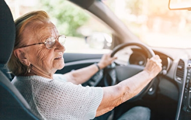
Traveling alone in an unfamiliar environment can be challenging for visually impaired pedestrians, largely because there is not enough information available to them to support decision making. For U of M researchers, helping these pedestrians overcome such challenges is a top priority.
“To improve mobility, access, and confidence in the transportation system, it is important to remove not only the physical barriers but also the information barriers that can impede mobility for people who are visually impaired,” says Chen-Fu Liao, senior systems engineer at the U of M’s Minnesota Traffic Observatory.
In previous work, Liao developed the Mobile Accessible Pedestrian System (MAPS), which uses smartphone technology to provide location and signal timing information to visually impaired pedestrians. In a subsequent project, Liao expanded the system to provide alerts and routing instructions for navigating work zones.
Liao collaborated with Vision Loss Resources (VLR) throughout the development of his system. Kate Grathwol, VLR president and CEO, explains that the agency teaches blind and visually impaired Minnesotans how to cross streets, where to catch light rail, and how to use the bus—skills that give them independence—“but then the world changes, and there’s road construction, or a sidewalk closed,” she says. Since visually impaired pedestrians are unable to read signs, they may need to ask for help.
“That’s not a bad thing, but nobody else has to—they can see. The real impact of this app is that it allows the same access for the blind and visually impaired that sighted people have,” Grathwol says.
Although MAPS received positive feedback from testers, Liao discovered the GPS technology underlying the system was not reliable enough.
“Because we provide information to the visually impaired, we cannot afford to provide wrong information [even] one time,” Liao says.
Liao’s latest project, sponsored by the Roadway Safety Institute, aims to improve the app’s accuracy and reliability by developing a “self-aware” infrastructure system—one that can monitor itself and ensure the information it’s providing is up to date, even in a GPS-unfriendly environment.
Researchers began with commercial Bluetooth low-energy (BLE) beacons, such as the kind that can be used to locate a misplaced purse or keychain. Since these BLE beacons are primarily designed to be detected and not communicate with each other, the researchers are integrating them with the necessary interface elements to sense other BLE devices within their range, Liao says.
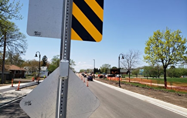
The BLE beacons can be placed on traffic barrels, barricades, signs in work zones, or at decision locations—such as store entrances—in indoor environments. Then, using a positioning and mapping algorithm, the system can estimate a user’s location based on nearby Bluetooth signals, share information among nearby devices, and inform the system administrator if any information has changed. The system can also detect when any of its beacons are not functioning—due to a loss of power or vandalism, for example.
Work on this project is currently under way. In the project’s final phase, researchers will integrate the Bluetooth system with the smartphone app and then conduct real-world tests of the new technology.