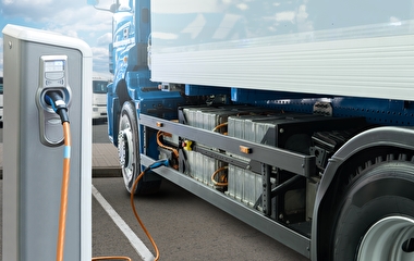
Recently, unmanned aircraft systems (UAS) have been making headlines for their wide-ranging applications—from aerial photography to package delivery for major retailers—and for their accompanying regulatory, safety, and privacy concerns.
In an October 15 Roadway Safety Institute seminar, Associate Professor Demoz Gebre-Egziabher of the U of M’s aerospace engineering and mechanics department reviewed some UAS-related opportunities and challenges. He also reviewed some of the UAS research being conducted at the U of M’s Uninhabited Aerial Vehicle (UAV) Laboratories.
Gebre-Egziabher focused on small UAS—systems with aircraft that weigh less than 50 pounds and fly slower than 100 mph and lower than 500 feet.
“There are all kinds of envisioned applications for UAS,” Gebre-Egziabher said. “They’re particularly being envisioned for use in what are called the three Ds—or the dangerous, the dirty, and the dull activities.”
These applications could include flight testing, environmental monitoring, and—in the transportation industry—traffic and infrastructure monitoring activities, such as inspecting bridges and railways.
“Most everyone is convinced that there’s great economic benefit in using UAS in infrastructure surveillance and management,” Gebre-Egziabher said.

bridge inspection. Photo: Collins Engineers
For example, small UAS can be equipped with cameras and used to inspect bridges, improving efficiency and safety for inspectors and reducing the need for specialized inspection equipment. They could also be used to inspect other hard-to-access infrastructure, such as railway tracks in remote areas.
However, cautioned Gebre-Egziabher, many technical issues must be addressed to make the widespread use of UAS in these situations safer and more reliable.
“Right now, reliability is on the atrocious side,” Gebre-Egziabher said. “This is partly because a lot of the hardware that goes into these small UAS comes from the hobbyist or remote-control aircraft community. They were never intended to be reliable, industrial-grade systems.”
But the primary issue, according to Gebre-Egziabher, is that almost all on-board control systems of UAS rely heavily on GPS.
“Whenever there is a denial, a stressing, or a spoofing of GPS, bad things happen,” Gebre-Egziabher said. Position, velocity, and attitude (orientation) measurements can all be negatively affected if a GPS signal fails.

“So, if you’re operating next to a large metallic structure like a bridge that’s reflecting or blocking GPS signals, you’re going to start getting degraded performance,” he said.
Therefore, the challenge is to develop a back-up system that allows UAS to continue operating in these situations. Potential solutions include vision- or camera-based navigation systems and cooperative or networked navigation, in which a group of vehicles working together could exchange information to maintain positioning accuracy even in the absence of GPS.
Researchers at the U of M’s UAV Laboratories have conducted research on the latter solution, which could be particularly relevant for bridge-inspecting UAS. This project tested a fleet of seven vehicles, with two of them operating beneath a bridge without access to a GPS signal.
Findings showed that this network configuration could help keep positioning errors in check for several minutes of operation, which would work well in situations where vehicles are traveling in and out of GPS signals for short periods of time. However, the networking system would be less effective if the GPS signal loss was prolonged.
“The bottom line is that there won’t be one silver bullet,” Gebre-Egziabher said. “The best solution will have to depend on the UAS application.”
The U of M isn’t alone in exploring the use of UAS for infrastructure monitoring. The Minnesota Department of Transportation (MnDOT) recently conducted its own project investigating the feasibility of using UAS to inspect Minnesota bridges. The project and its findings were outlined in a recent post on the CTS/MnDOT Crossroads blog.
“[The project gave] us an idea of what a drone could provide, what the limitations were, and what features we would like to see on newly available UAV models,” said Jennifer Zink, MnDOT bridge inspection engineer.
A second phase of the project is set to begin before the end of the year. If the project is successful, the future use of UAS could potentially decrease MnDOT’s costs and increase bridge inspection abilities, Zink said. “It could improve inspection data collection for local agencies as well.”